
Springfield ZIP Code Directory Coverage
Springfield's current city context uses six local ZIP designations: 45501 through 45506. The City's 2025 community-needs survey includes all six. The available city ZIP map is from 2013, so it offers a broad orientation rather than a current delivery boundary. The table separates documented postal evidence from useful local direction. For a particular home or business, the official USPS address lookup is the final postal check.
| ZIP code | Areas covered | Post office evidence | Verification note |
|---|---|---|---|
| 45501 | Central postal-facility context. | Springfield Post Office is documented at 150 N. Limestone Street. | PO Box service is confirmed, but exclusive PO Box use is not established. |
| 45502 | Included in the City's current survey. | No separate post office assignment was verified. | Street-level footprint was not verified; do not infer a city boundary. |
| 45503 | Northeast orientation on the 2013 city map. | No separate post office assignment was verified. | Historical orientation only; USPS confirms an address. |
| 45504 | Northwest orientation on the 2013 city map. | No separate post office assignment was verified. | Historical orientation only; USPS confirms an address. |
| 45505 | Southeast orientation on the 2013 city map. | No separate post office assignment was verified. | Historical orientation only; USPS confirms an address. |
| 45506 | Southwest orientation on the 2013 city map. | No separate post office assignment was verified. | Historical orientation only; USPS confirms an address. |
The table gives a cautious local frame, not an assignment of every Springfield street. A postal area serves delivery routes. It is not a parcel boundary, city-limit map, or resident roster.
2013 Springfield ZIP Code Orientation
The 2013 city ZIP map can help orient a reader after an address has been validated: 45503 appears northeast, 45504 northwest, 45505 southeast, and 45506 southwest. It does not show a current USPS delivery decision for every street. The map also predates the present city survey categories, which include 45501 and 45502. That contrast is why the historic map should be used as an orientation aid, not as postal proof.
Postal processing records add a separate caveat. A December 1, 2016 Postal Bulletin change affected container-label processing for 45502 through 45504, moving from a 45501 label convention to 45502. That was a processing detail, not evidence that streets changed ZIP code boundaries. Confirm a mailing address through USPS rather than drawing a conclusion from a processing label.
Springfield ZIP Code Search Limits
No local property, Recorder, court, or voter portal documented in the research accepts a ZIP-wide resident search. The Clark County Auditor has address, owner, parcel, sale, City/Township, neighborhood, subdivision, legal, and physical criteria, but no ZIP field. Ohio My Voter Information requires a person's first name, last name, and county. It is not a browsable ZIP directory. A valid ZIP narrows a location question, then the address opens the official property path.
- Use the official USPS address lookup to validate the complete delivery address and postal ZIP code.
- Use the Auditor's City/Township criterion and the City zoning map to determine the likely government jurisdiction for the property.
- Enter the house number and street components in the Auditor search. Preserve the parcel number and legal description from a matching result.
- Use the parcel and legal description for Recorder, Tax Map, permit, or historical-directory work as appropriate to the question.
- Once a ZIP has narrowed the location to a street, use the Springfield Street Directory for the address-by-address record sequence.
The Ohio Division of Unclaimed Funds has optional City and ZIP narrowers, but it is a claim lead rather than a resident directory. The state DRC search has a ZIP field for limited custody or supervision data, not for general address research. Neither fills the missing local ZIP-wide property or voter search.
Springfield Auditor Fields After ZIP Validation
After USPS confirms the mailing ZIP, the Clark County Auditor Property Search works from parcel, owner, or address details. This is the correct shift from postal geography to property records. The advanced form can narrow a location question, but its documented filters do not include ZIP. Avoid substituting a nearby ZIP assumption for the exact house number and street components.
| Auditor field | What it narrows | ZIP code boundary |
|---|---|---|
| Search by Parcel, Owner or Address | One broad property query. | No ZIP option is documented. |
| House #, Direction, Street Name, Street Type | A physical address. | Use after USPS validates the delivery address. |
| City/Township | Governmental property location. | More useful than a postal label for jurisdiction. |
| Neighborhoods and Subdivisions | Local property context. | Dropdown options load dynamically. |
| Legal Description | Lot, block, subdivision, or recorded land reference. | Links an old address to recorded geography. |
| Sales and physical criteria | Transfer or parcel characteristics. | Not person or ZIP-wide filters. |
Clark County is updating parcel data through its reappraisal work. Use a current parcel result as a lead and verify the custodian's record before relying on a changing property detail.
The Clark County reappraisal update shows the current parcel-data refresh context.
A data refresh explains why a parcel detail can change. It does not establish a new owner, resident, or ZIP assignment by itself.
45501 and the Springfield Post Office
The documented Springfield Post Office is at 150 N. Limestone Street, Springfield, OH 45501-9998, and its listed phone is 937-323-6497. The USPS location record confirms PO Box service and delivery details at that facility. It does not state that 45501 is exclusively a PO Box ZIP, so a specific address still needs the USPS lookup rather than an assumption based on the post office address.
The official USPS Springfield Post Office listing provides the postal-facility reference for this local postal search.
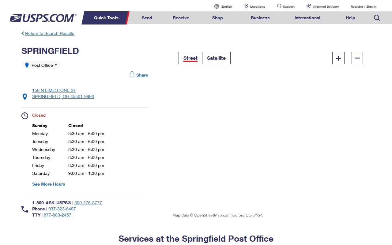
The facility information supports postal validation, while the Auditor and city resources answer separate parcel and jurisdiction questions.
Address Forms Within a Springfield ZIP Code
One Springfield location can carry several address descriptions, each with a different use. The Auditor's situs field concerns the physical parcel. A tax-mailing field identifies where correspondence is sent. Recorder, Tax Map, and Auditor records use legal descriptions to connect a lot or subdivision across address changes. USPS assigns a ZIP for delivery. Treating those fields as interchangeable can attach the wrong jurisdiction or person to a property.
| Address form | Keeper or use | What it establishes |
|---|---|---|
| Situs address | Auditor parcel record | Physical parcel address keyed by house number and street components. |
| Tax mailing address | Auditor parcel card | Owner correspondence route, not proof of occupancy. |
| Legal description | Auditor, Recorder, and Tax Map | Recorded lot, block, subdivision, or land description. |
| Postal ZIP | USPS delivery lookup | Mail-routing assignment for a delivery address. |
| City/Township | Auditor location criterion | Property jurisdiction context within the county. |
Note: A tax-mailing address and a postal ZIP can both be useful leads, but neither establishes who occupies a Springfield situs address.
Former Springfield Streets and ZIP Assumptions
A historic street name should not be forced into a modern ZIP code. Heritage Center's street-name-change inventory includes a 1961-prepared compilation with former names and some change dates. Yellow Springs Street and Plum, plus older Main and Champion references for Columbia Street, illustrate why a name match can fail. Search the former and current names, compare cross streets, and use Tax Map plats, surveys, road records, and dated maps to reach the legal description.
The available Sanborn sequence can help place a block in its period, but it does not determine a current ZIP or occupant. The Ohio Web Library lists Springfield editions for 1886, 1891, 1894, 1910, 1928, the 1928-August 1950 period, and a 1955 republication. A former street label is historical evidence, not a shortcut around modern postal validation.
Springfield ZIP Codes and City Limits
A ZIP code boundary, a City of Springfield limit, and a Census ZCTA are distinct geographies. A Springfield mailing label or 455xx ZIP does not establish which authority assigned an address or which zoning office has the record. For unincorporated Clark County, the county address-assignment process is routed through Planning and Zoning. For a City address, City Planning and Zoning is the first local contact. Verify the exact jurisdiction through the Auditor's City/Township field and the zoning map.
- ZIP code and ZIP+4
- A ZIP code routes mail to an area; ZIP+4 adds a more specific delivery segment. Neither is a property boundary.
- PO Box ZIP
- A postal designation used for post-office boxes. Facility PO Box service does not prove an entire ZIP has only boxes.
- Unique ZIP
- A ZIP associated with a single organization or delivery arrangement. No Springfield unique ZIP was verified in the research.
- Carrier route
- A delivery sequence used by mail carriers, not a city-limit or resident-list boundary.
For City Planning and Zoning, the documented first contact is 76 E. High Street, second floor, Springfield, OH 45502, 937-521-8096. The unincorporated county address-assignment route is a separate process at county Planning and Zoning. Keep those paths separate when a postal label crosses the city edge.
Clark County's unincorporated address-assignment material asks for an owner or agent contact, parcel number, and a survey or Auditor map showing the proposed driveway. That county process is routed to Planning and Zoning at 3130 E. Main St., Suite 1A, Springfield, OH 45503, 937-521-2160. Those requirements demonstrate why an address question should begin with the parcel and jurisdiction rather than a ZIP label alone. A property with a Springfield mailing address may still need a county, rather than City, records path.
Use a ZIP code to verify mail delivery, use City/Township and zoning information to identify jurisdiction, and use the parcel number or legal description to connect property records across time. This three-part check is especially helpful when a former street name appears in a directory or map. It also prevents an old postal reference from being treated as a current boundary or a statement about who lives at an address.